WalkBike.Info
  • Communities
    • Center Line
    • Dearborn
    • Detroit
    • Frankenmuth
    • Grand Rapids
    • Grand Region
    • Jackson
    • Lenawee
    • Livingston
    • North Kent
    • Pontiac
    • Roseville
    • Springboro
  • Search
  • Menu Menu
  • Home
  • Plan
  • Schedule
  • Downloads
  • Arabic

A considerable amount of data was collected, mapped and analyzed during the development of this plan and is summarized here. The
data and analysis, coupled with stakeholder input, informed the development of the plan recommendations.

Roadway Inventory

  • Overview
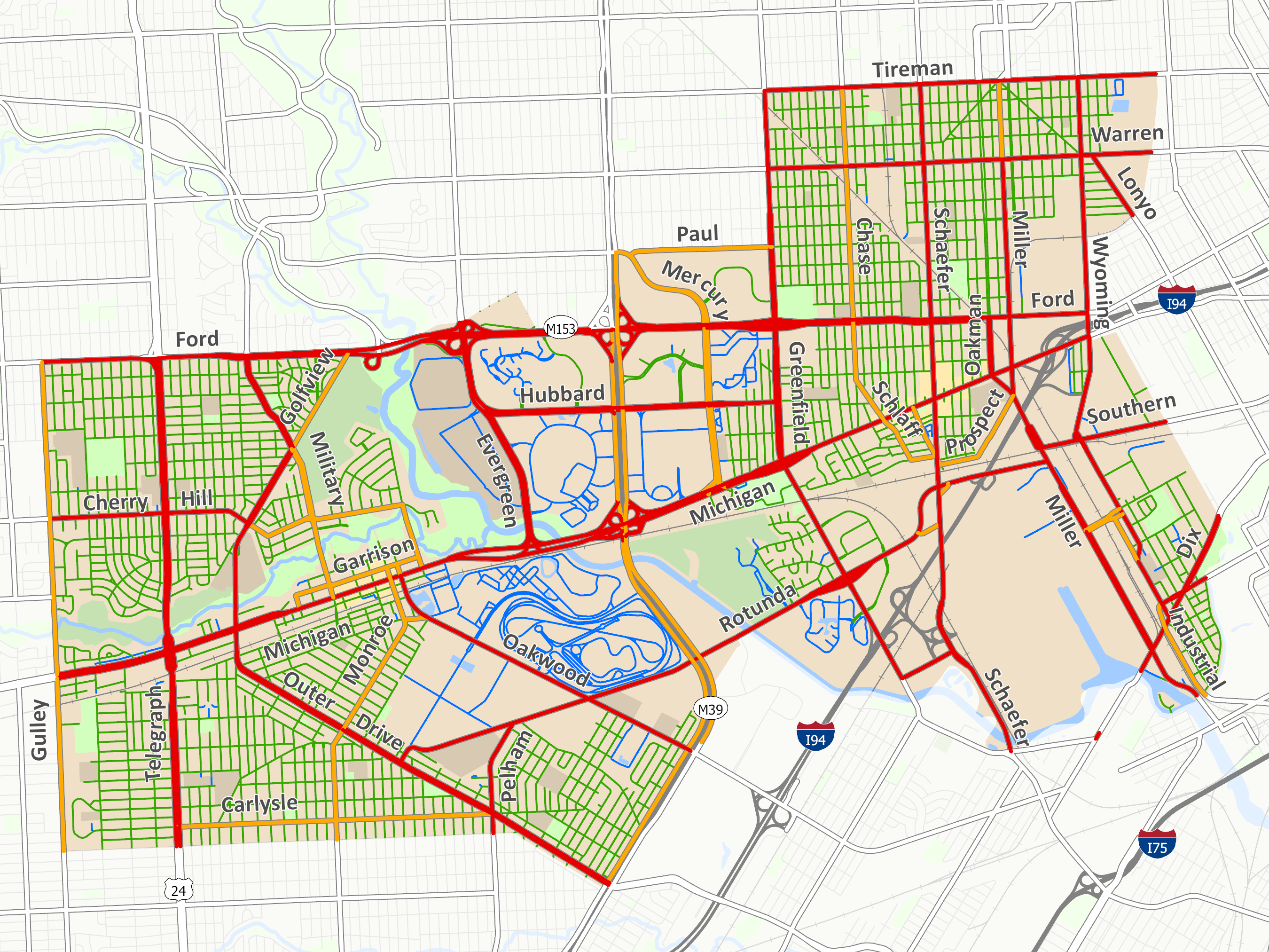
    • 135 linear miles of roadways
    • 6 square mile of public right-of-way
    • 24% of your entire City’s footprint
    • There are functional and jurisdictional hierarchies of the roadway system
    • The road system falls under three public agencies and a number of private agencies
    • The City’s complete street resolution and state law require that local plans and concerns
      be addressed
    • Traffic speed is the most significant factor in safety of all modes
    • The Arterials were designed to move a lot of vehicles at a high rate of speed
    • Higher speeds do not necessarily equate higher volumes
    • Signalized intersections are the bottle necks, they can regulate speed and are the
      primary determinant of capacity
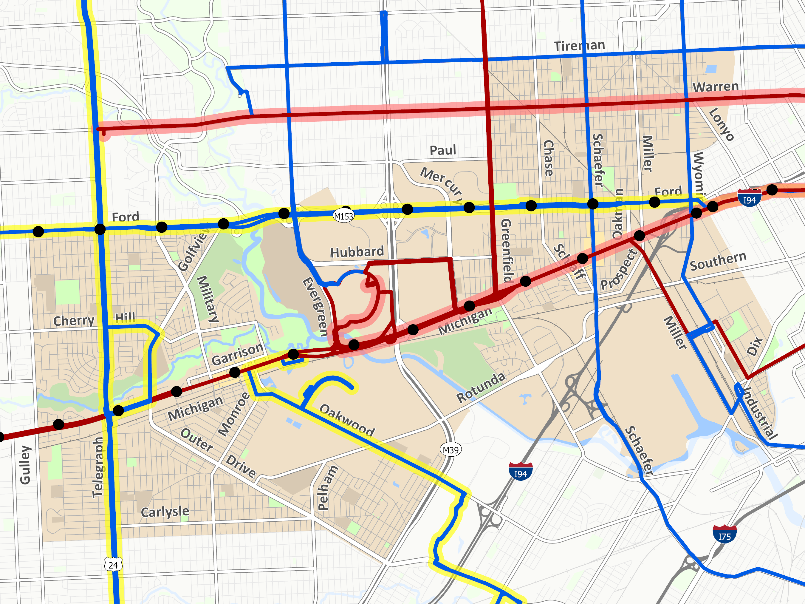
    • Tremendous number of six or more lane boulevards: Ford, Telegraph, Michigan, Greenfield – these present unique opportunities and challenges.
View Roadway Inventory Maps

Travel Patterns

  • Land Use
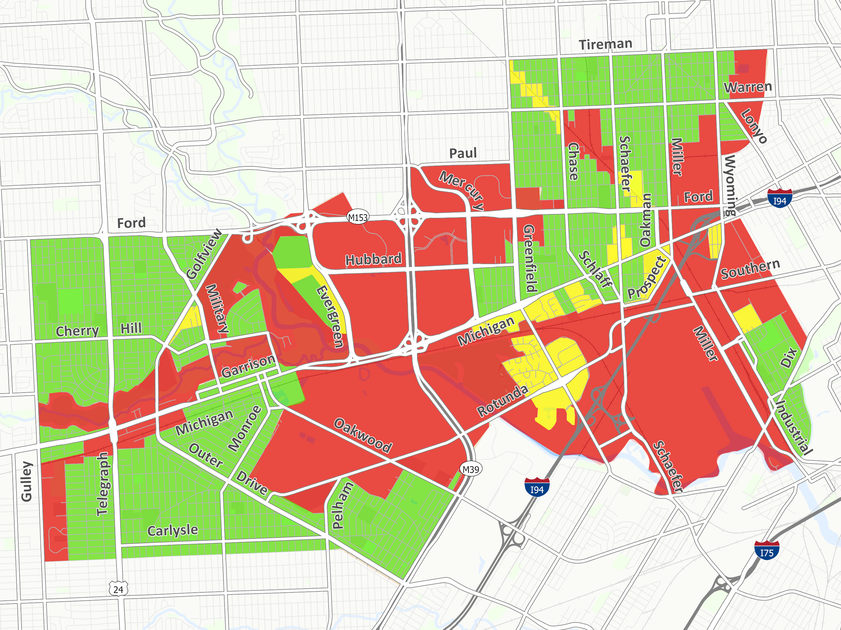
    • Dearborn has 2 Downtowns – no single city center
    • Suburban campus development between the Downtowns
    • Strip development along major roadways
    • Future land use calls for more focused development centers
  • Directness of Travel
    • East and West Downtowns are mostly cut-off from the residential areas
    • Half of the city is comprised of large unpopulated block of land that act as barriers
View Travel Pattern Maps

Crashes

  • Pedestrian Crashes
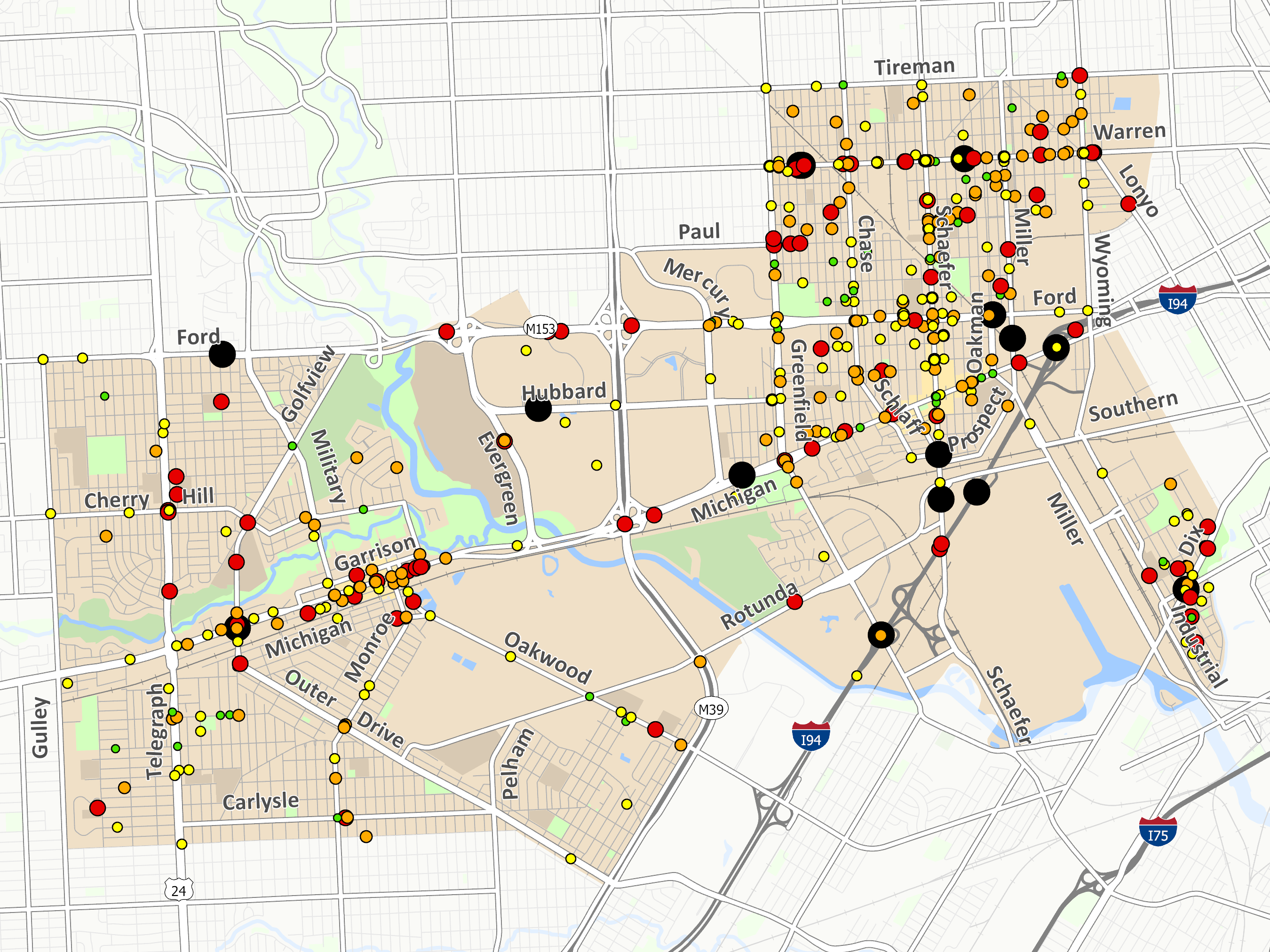
    • About 40 crashes each year
    • On average between 4 and 5 pedestrians die on the streets each year
    • Driver’s age matters: Young drivers 19%; Old drivers 14%
    • Location matters – 64% are mid-block (between intersections)
    • Most unusual finding – Number of serious crashes on local roads
  • Bicycle Crashes
    • Average 26 crashes each year of which between 2 and 3 result in an incapacitating injury
    • 80% of bicyclists were going straight ahead when they were hit by a motor vehicle
    • Drivers age matters: Young drivers 22%; Old drivers 13%
    • Location matters – 82% are on the road; 61% are at intersections
    • Most unusual finding – number of serious crashes on local roads
View Crash Maps

Pedestrian Access + Mobility

  • Sidewalks:
    • Few gaps in the residential areas
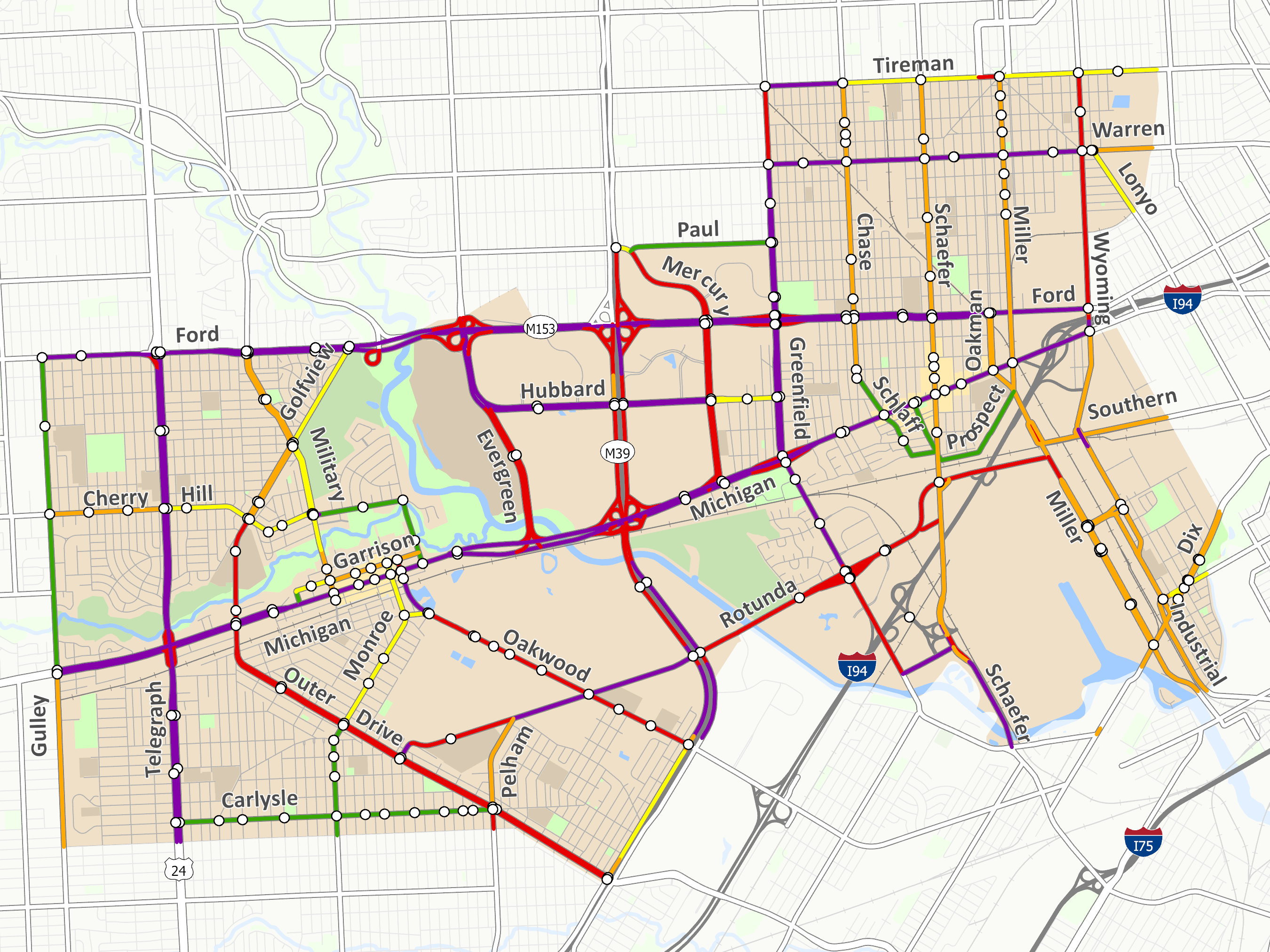
    • Along major roadways the pedestrian level of service drops dramatically on many major roads and fails in the center of town
    • Spacing of existing crosswalks is too far apart throughout the City
    • Many of the existing crosswalks, signalized and mid-block lack basic crosswalk components and are deficient
    • The configuration of most of the roads call for a substantial crosswalk solution
  • School Barriers:
    • Major roads that bisect school draw areas will warrant additional measures: Cherry Hill, Monroe, Greenfield, Chase
    • Stout Middle School and Edsel Ford High School have the most physical barriers and remote draw areas
    • Southeast corner of town has the most neighborhoods cut off from the middle and high schools
View Pedestrian Access + Mobility Maps

Bike Access + Mobility

  • Regional Connections:
    • At a regional level, Dearborn is not currently a destination for people who bike – there are no through town trail elements at this time
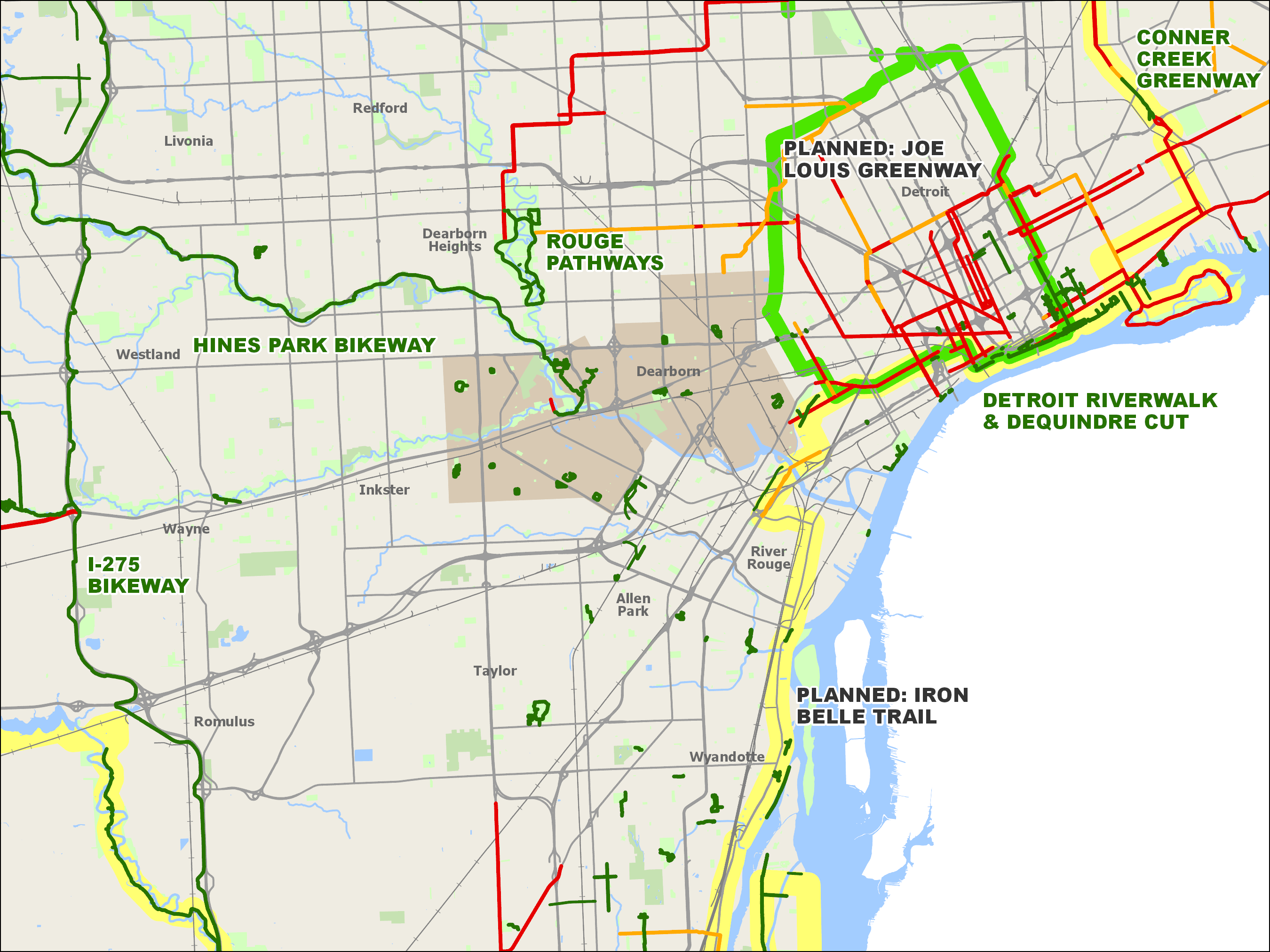
    • Rouge River Gateway Trail is the City’s tie into the regional trail system
    • Potential to tie into existing networks in Detroit via Oakman Blvd, Outer Drive, Michigan Ave, Dix and Vernor Ave
    • Potential to tie into the Iron Belle Trail to the southeach and Joe Louis Greenway to the northeast
  • Roadways
    • Opportunity for extensive system of low stress bike routes along local roads – the weak point in the system are the major road crossings
    • Some road lanes are unnecessarily wide and could be narrowed to provide bike lanes within the existing curb
    • Some roads appear to have excess lane capacity, providing opportunities for lane reductions
View Bike Access + Mobility Maps

Transit Access

  • Train:
    • Amtrak is not set up as a commuter rail
    • There are issues with on-time performance due primarily to shared track with freight trains
  • Buses:
    • Serviced by DDOT and SMART
    • 1 hour headway’s on the majority of routes
    • Limited weekend service for the majority of the City
    • East half of Michigan Ave and Warren have 24 hour service and 30 minute headway’s
    • West half of the city is the most undeserved transit area
View Transit Access Maps
Back to Home Page

Scroll to top