WalkBike.Info
  • Communities
    • Center Line
    • Dearborn
    • Detroit
    • Frankenmuth
    • Grand Rapids
    • Grand Region
    • Jackson
    • Lenawee
    • Livingston
    • North Kent
    • Pontiac
    • Roseville
    • Springboro
  • Search
  • Menu Menu
  • Home
  • Plan
  • Public Input
  • Schedule
  • Resources

A considerable amount of data was collected, mapped and analyzed during the development of this plan and is summarized here. The
data and analysis, coupled with stakeholder input, will inform the development of the plan recommendations.
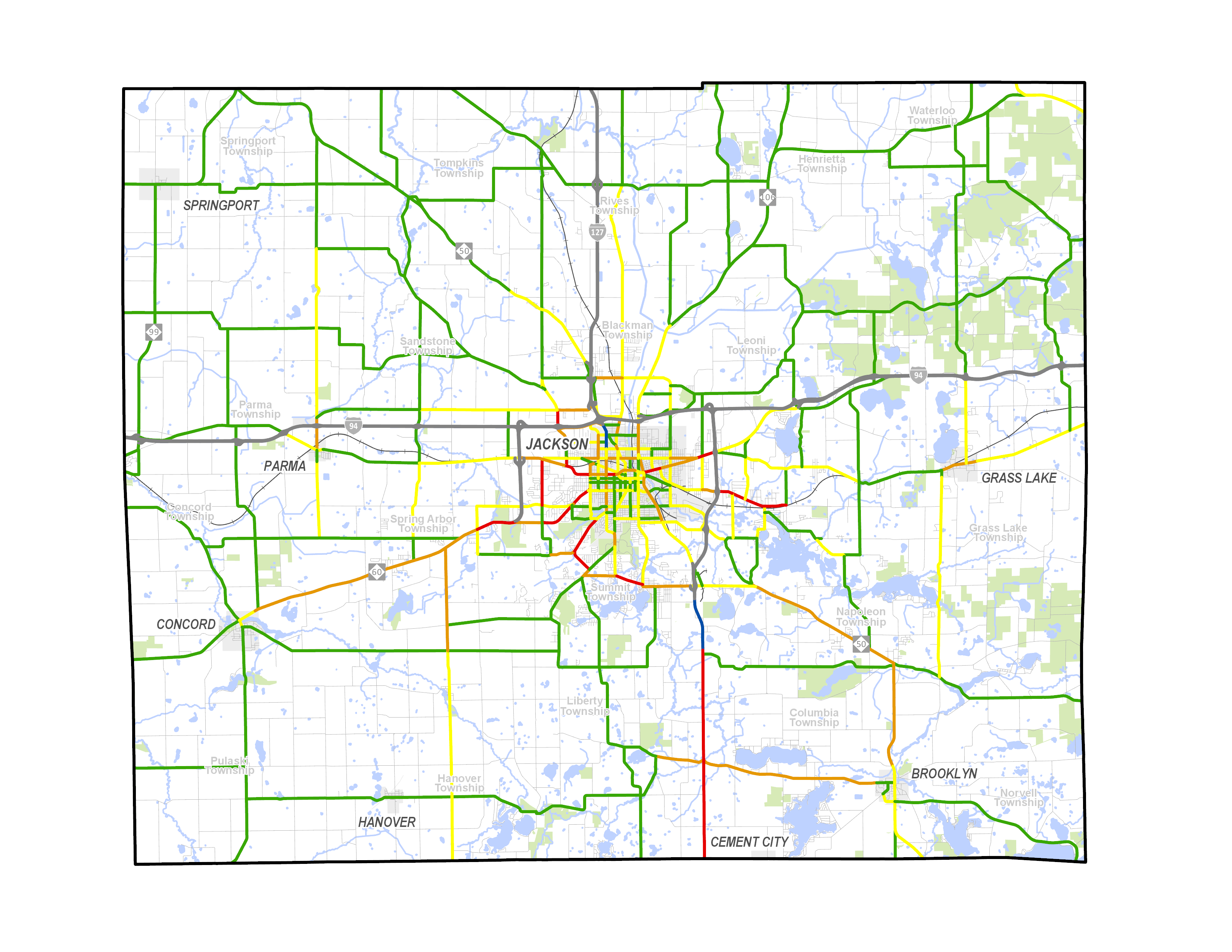
Click here to view all Inventory + Analysis Maps

Regional Context & Plan Framework

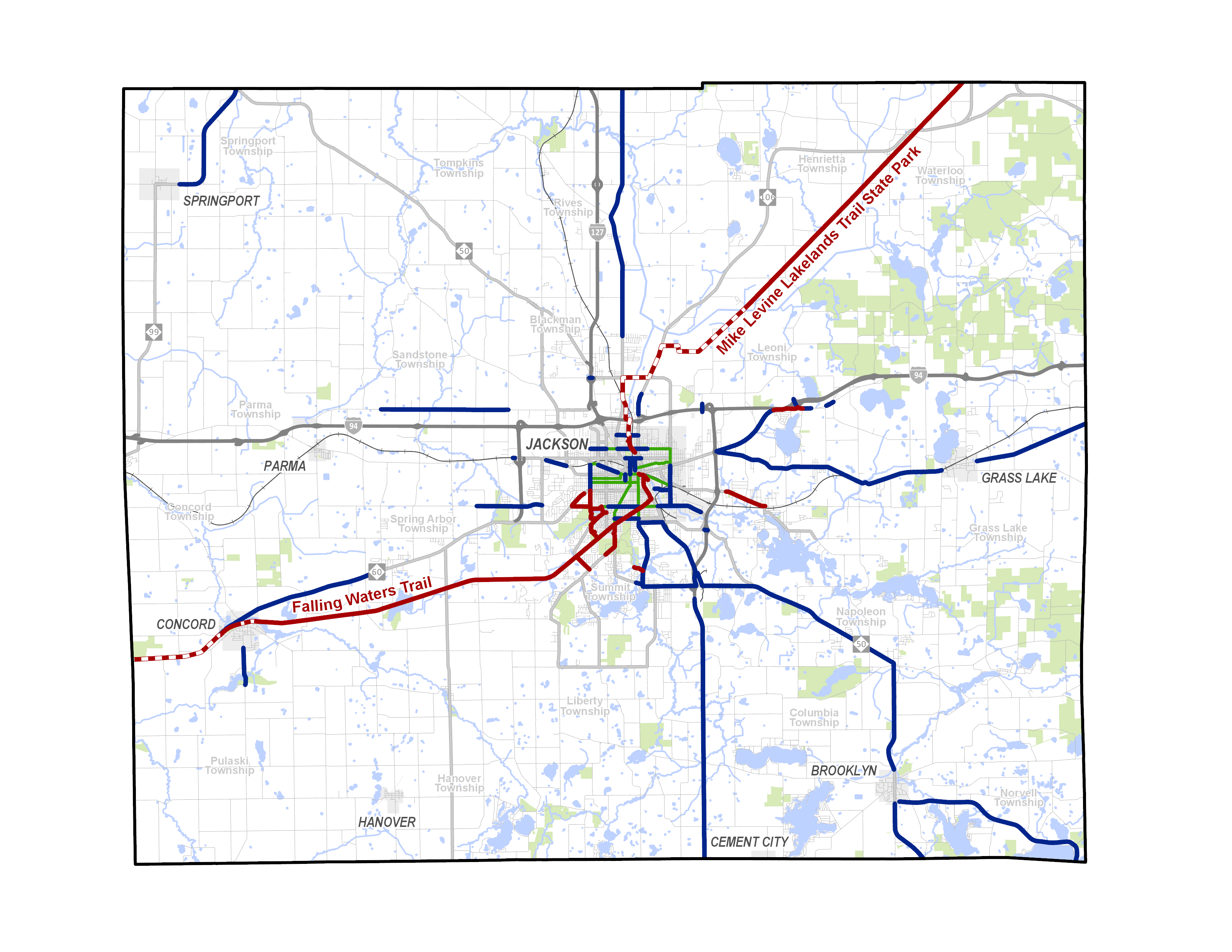
  • Two major cross-state trail designations
    • Iron Bell Trail
    • Great Lake to Lake Trail
  • Proposed trail connections in existing plans
    • Primarily on the east side of the county
    • May be challenging to implement due to topography, utilities, drainage swales and wetlands
  • Plan Framework
    • Central activity hub of the City of Jackson
    • Five satellite commercial centers: Springport, Parma, Concord, Hanover, Brooklyn and Grass Lake
    • Around each commercial area is a commuter walking zone
    • In Jackson, there is the addition of a commute biking zone
    • The plan will look at how to improve each of these centers and zones as well as create links between them

Roadway Inventory

  • Overview
    • Many of the main roads through out the county have low traffic volumes and high speeds
    • Traffic speed is the most significant factor in safety of all modes
    • Opportunities for adding paved shoulders; JDOT has a new road resurfacing machine
    • May be opportunity to promote backroad bike routes on gravel roads (Waterloo Rec. Area and Sharonville Game Area)

Community Health

  • Health
    • 37% of adults are obese
    • 23% of adults are physically inactive
    • 73% of the population has adequate access to locations for physical activity
    • Daily active transportation trips should be encouraged in areas with high rates of blood pressure, diabetes, and obesity
    • Study’s show the first 22 minutes of moderately vigorous physical activity each day reduces many chronic diseases by up to 50% (there is not a pill that can do that!)
    • The best way to integrate more physical activity into your life is to integrate it into your typical daily activities (e.g. walk to work, bike to the store)
    • The quality of the walking and bicycling experience is key
    • To obtain the benefits we must remove the barriers and establish an system that attracts people
  • Vulnerable Populations
    • Areas with with low income, limited or no access to a vehicle and high social vulnerability levels are more likely to depend on walking, bicycling and transit as their primary means of transportation
    • 8% of the county residents live in households without a car
    • 17% of City of Jackson residents live in households without a car

Land Use + Travel Patterns

  • Commute to Work
    • 82% of commute to work trips are people who live and work in the County
    • 84% of the workforce drive alone to work
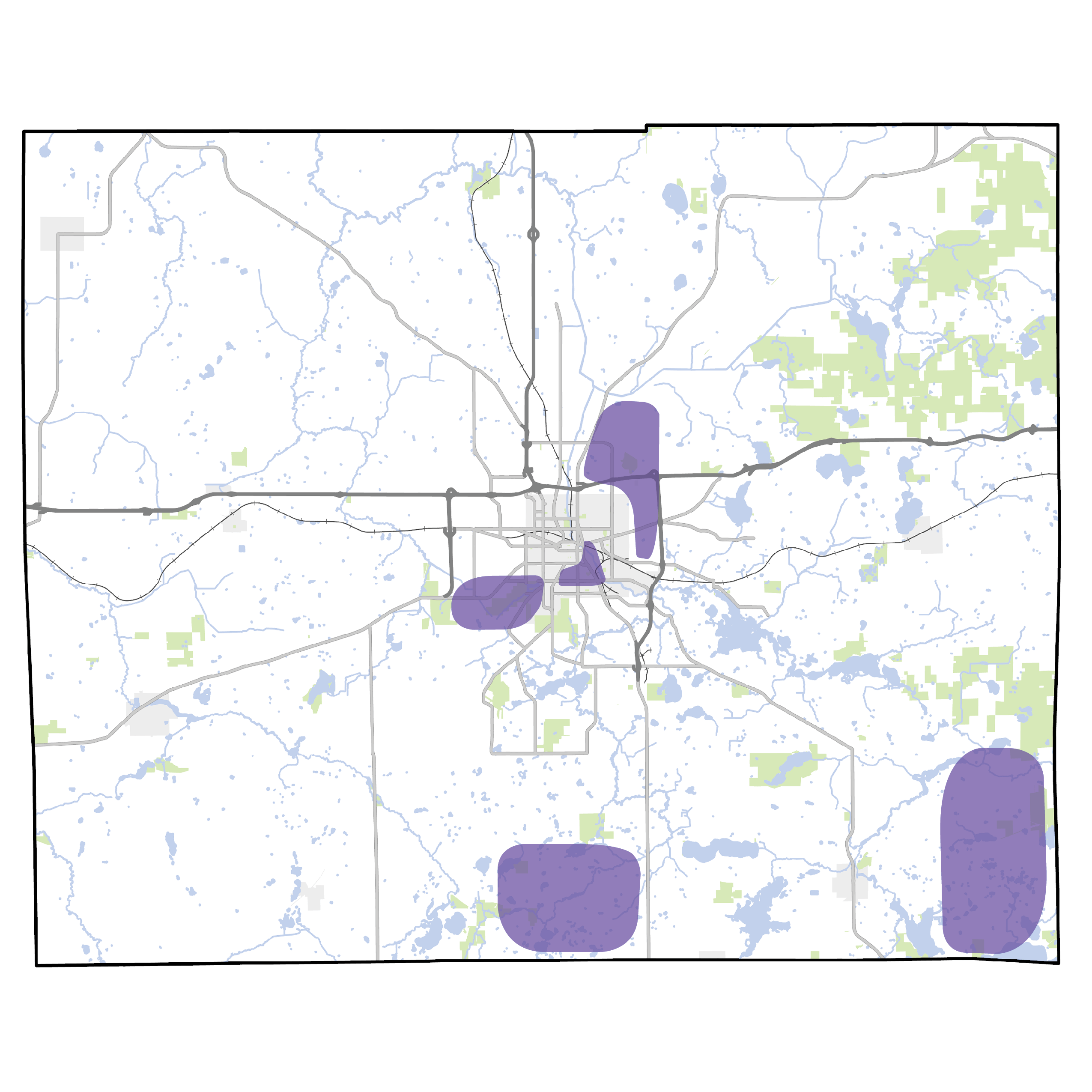
    • Spring Arbor University reflects the higher number of people who walk and bike to work west of Jackson (large census tracks)
    • High number of bike, walk and take transit to work elsewhere have a strong correlation with vulnerable population areas
  • Land Use + Directness of Travel
    • General areas with high population density, commercial activity, access to recreation school and transit, a mix of land uses and high connectivity promise the greatest return on investment
    • Downtown Jackson extending out to the Henry Ford Campus is very walkable
    • Other Commercial areas in the county are somewhat walkable
    • High numbers of bicycle and pedestrian activity in downtown Jackson, MLK Jr Equity Trail, Falling Water Trail, Cascades Park and Ella Sharp Park
    • The railroad and river act as significant barriers to bicycle and pedestrian travel around downtown Jackson
    • High Population density in City of Jackson and Southern Blackman Township
    • Area where we can make the most impact based on predictors of pedestrian and bicycle travel: The neighborhood near Henry Ford Campus in Jackson – to realize the potential, barriers to bicycle and pedestrian travel need to be addressed and the environment needs to be improved

Crashes

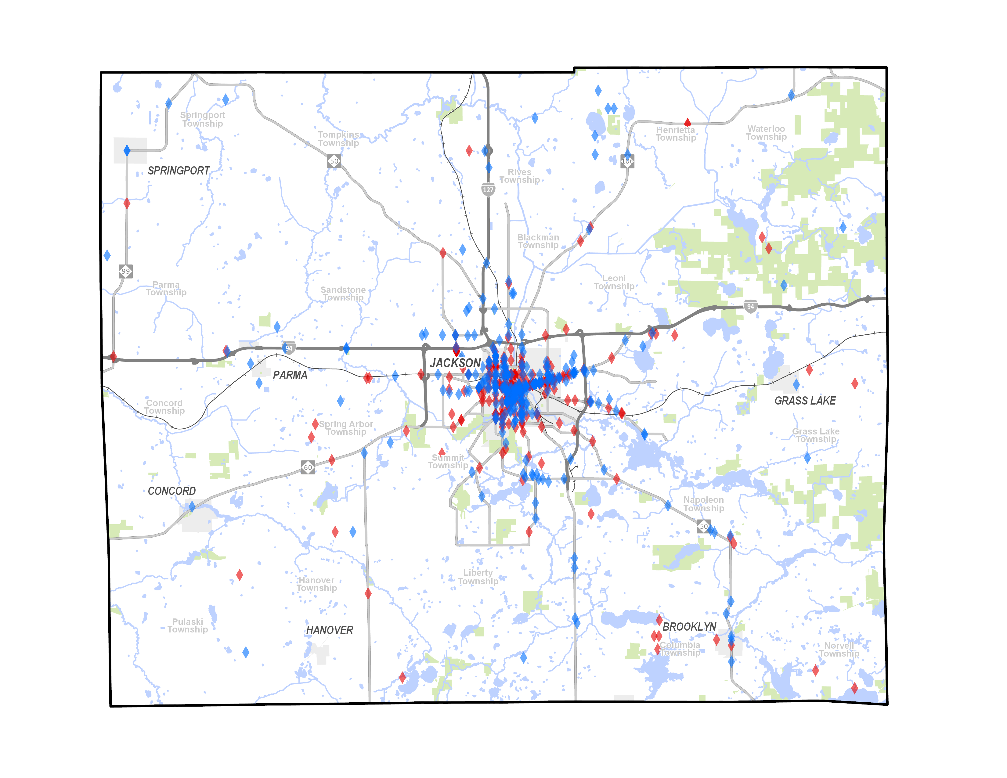
  • Pedestrian Crashes
    • About 30 crashes with more than one fatality each year
    • This represents <1% of all crashes, but...8 % of all fatal crashes and 7% of serious crashes
    • 42% of pedestrian crashes at intersections
    • Significant number of fatal and serious injury crashes in rural areas
    • Significant number of hit-and-runs (25%)
    • About half of all crashes caused death or injury
    • Economic cost of pedestrian crashes each year in the county: $2.7 million (productivity, medical, emergency and cost to employers)
    • Comprehensive cost of pedestrian crashes each year in the county: $17.1 million (economic cost plus quality of life valuations)
    • A HUGE emotional toll on the community
  • Bicycle Crashes
    • About 27 crashes with nearly 3 fatal crashes each year
    • This represents 0.5% of all crashes, but…4 % of all fatal crashes and 3% of serious crashes
    • 63% of pedestrian crashes at intersections
    • Significant number of fatal and serious injury crashes in rural areas
    • Significant number of hit-and-runs (25%)
    • About half of all crashes caused dealt or injury
    • Economic cost of bicycle crashes each year in the county: $1.5 million (productivity, medical, emergency and cost to employers)
    • Comprehensive cost of bicycle crashes each year in the county: $10 million (economic cost plus quality of life valuations)

Pedestrian Access + Mobility

  • City of Jackson
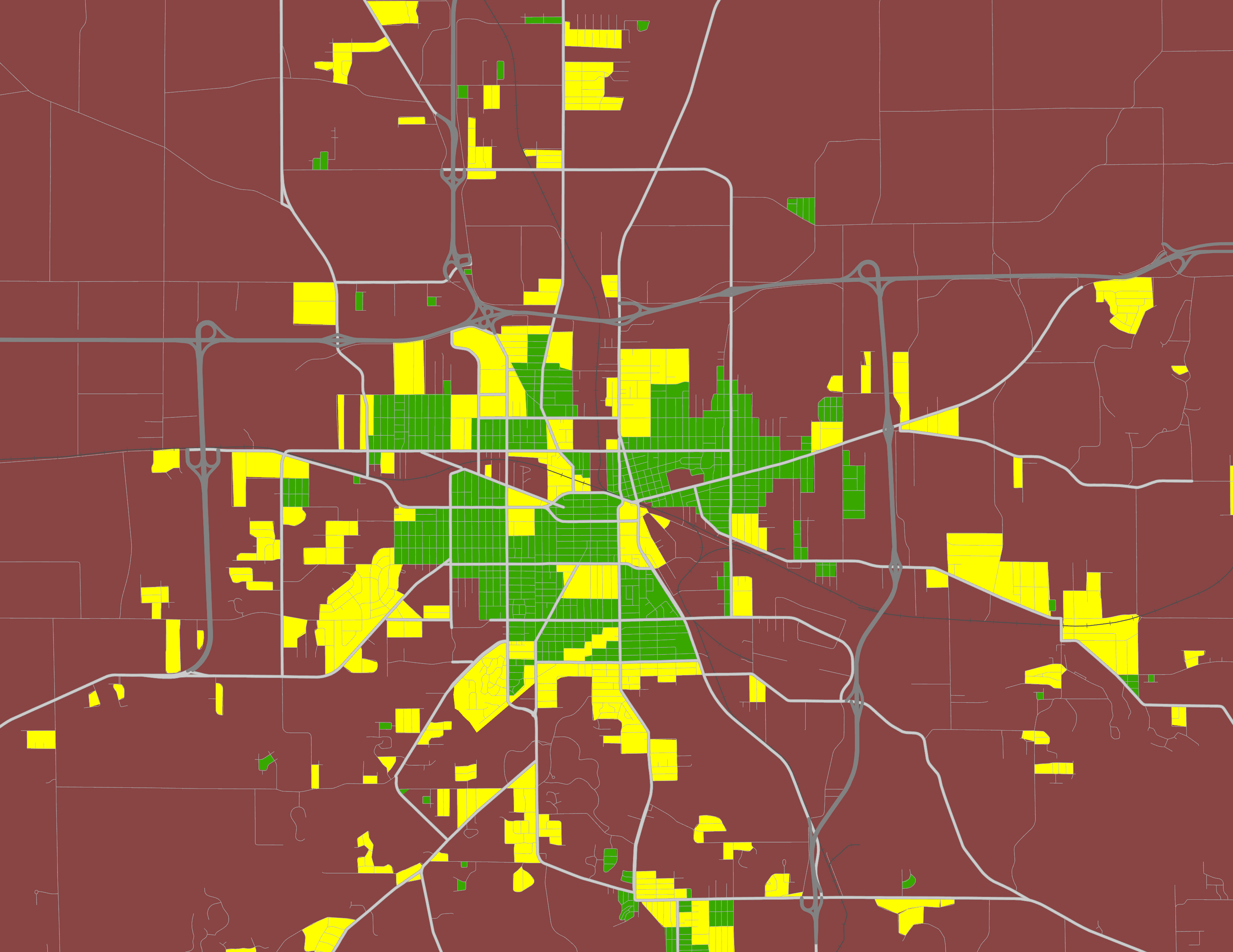
    • Majority of the City of Jackson has sidewalks on both sides of the street
    • Outside of the City, few residential streets have sidewalks and neighborhoods do not have a pedestrian link to the City or adjacent neighborhoods
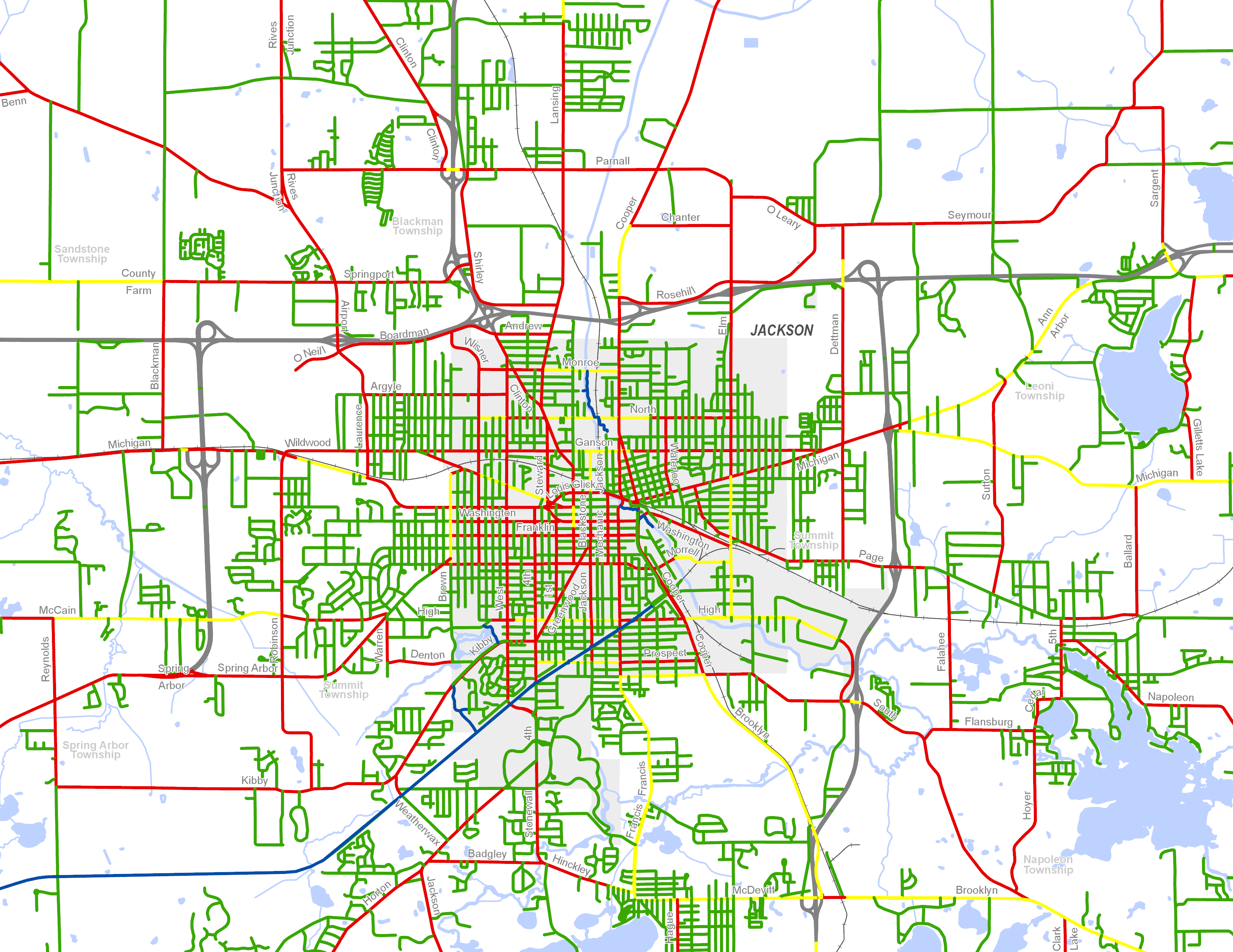
    • Strava maps show a clear association of the pedestrian use and presence of sidewalks
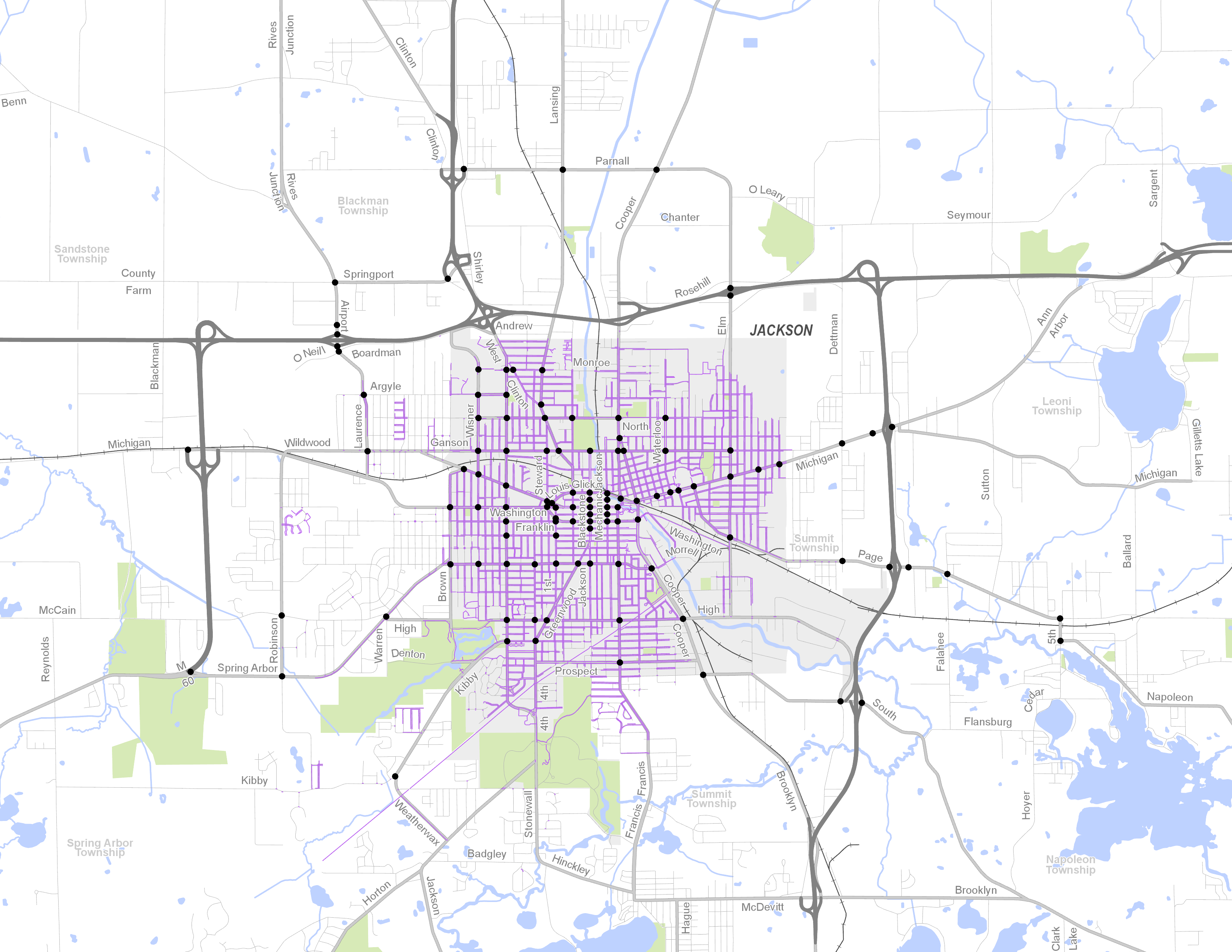
    • Getting across the street is a primary concern for people who walk and pedestrians will not detour more than 10% of their total trip distance
    • The existing crosswalks are too far apart throughout the city
    • Majority of corridors have over 1/4 mile stretches between crosswalk and signalized intersection
    • The current configuration of most roads calls for substantial crosswalk solutions; lowering speeds and removing unnecessary lanes helps dramatically
  • Pedestrian Routes in Townships
    • Primarily walking on the local roadways
    • Dispersed pedestrian crash locations on local roads – generally more minor injuries
    • Existing foot paths between neighborhoods illustrate the need to improve connections

Bike Access + Mobility

  • Bikeway Connections
    • Falling Waters Trail/Lakelands Trail almost complete across county
    • Paved shoulder bicycle connections between communities on the south east side of the county
    • Missing connections to the northwest quadrant of the county
  • Potential Trail Corridors
    • Many of the abandoned rail corridors identified in the previous plans may be difficult to implement due to fractured corridor ownership and homes and businesses built on the former corridors
    • May be opportunities with Consumers Energy Corridors (unsure how feasible and farmers may have easements to use the land)
  • Bicycle Stress
    • The local street network actually provides a pretty extensive “low stress” system
    • Weak point in the system are at busy road crossings due to lack of crosswalks and busy signalized intersection with no bicycle facilities
  • City of Jackson
    • A lot of roads appear to have excess lane capacity
    • Opportunity to link existing isolated bike lanes and paved shoulders
    • 4 to 3 lane conversions are a FHWA proven safety countermeasure for all modes and make pedestrian road crossings much easier

Transit Access

  • Amtrak Train
    • Improve connections from Train Depot to Downtown Jackson
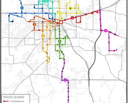
  • JATA Buses
    • Need basic information at all bus stops including route map and schedule
    • Basic facilities should include accessible concrete pad between sidewalk and curb at stops
    • Need to provide sidewalk connections to stops and crosswalks adjacent to them
    • Seven specific areas of concern are oulined in the Jackson County JATA 2018 Master Plan
    • General issues identified in the plan include accessibility of stops, safety and lack of crosswalks associated with stops

Environmental Factors

  • Topography + Wetlands
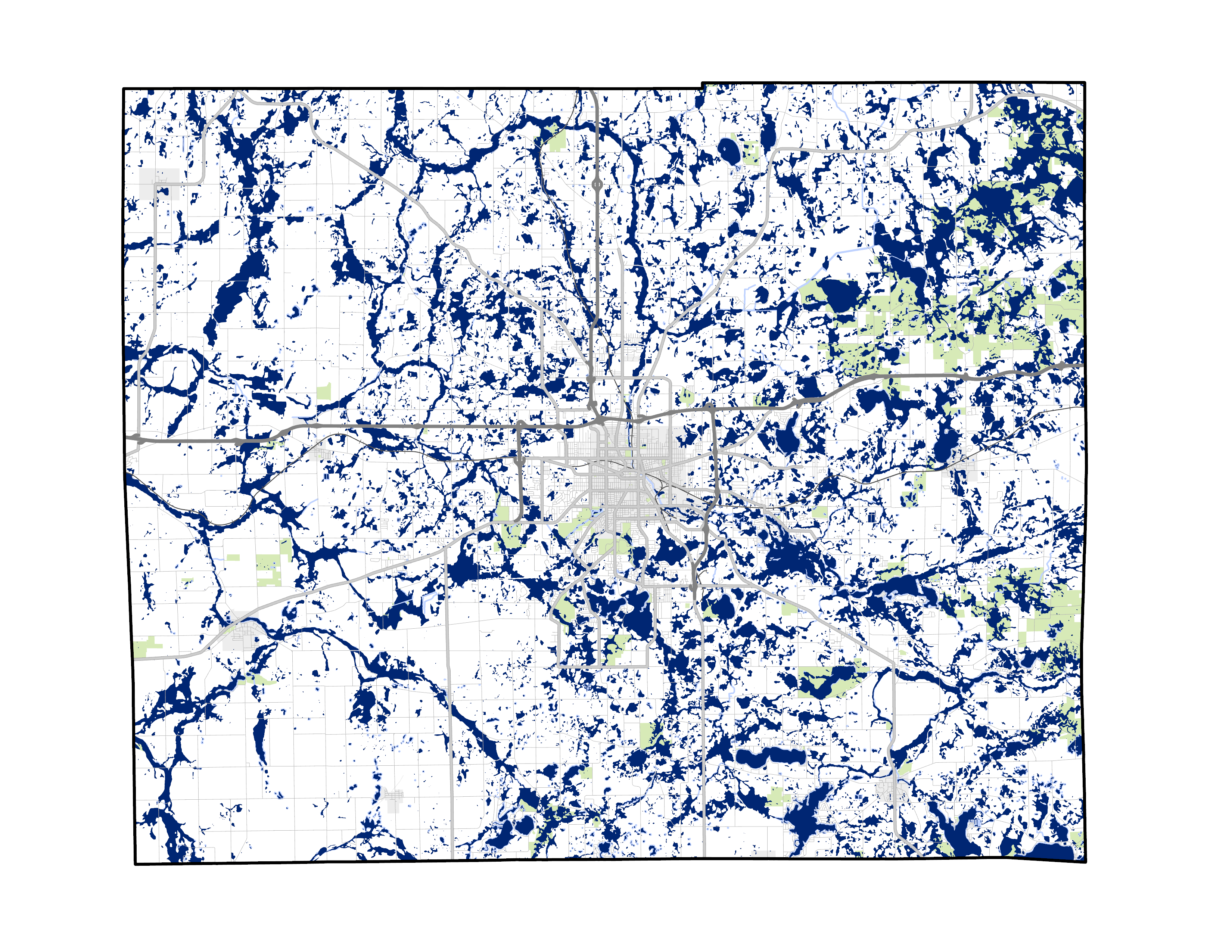
    • The extensive wetland system and hills that make Jackson County such a lovely place, also make construction difficult
    • They have significant impact on feasibility, permitting, accessibility, and construction costs for new sidewalks, paved shoulders, side paths, and shared use pathways

Brooklyn

  • Summary
    • Walkable Main Street Area
    • Potential for Bike Lanes on Constitution through lane narrowing and on Marshall if parking removed
    • ADA improvements needed at crosswalks
    • Few residential streets with sidewalks
    • Existing paved shoulders to Jackson, Hayes State Park, and the International Speedway

Concord

  • Summary
    • Falling Water Trail connects to Jackson (study underway to continue trail west to Albion)
    • Potential for Bike Lanes on Main Street if parking removed
    • ADA improvements needed at existing crosswalks
    • Few residential streets have sidewalks
    • Existing paved shoulder to Swains Lake and the edge of Spring Arbor

Grass Lake

  • Summary
    • Walkable Main Street area
    • Limited potential for Bike Lanes on Michigan, parking would need to be reconfigured
    • Improve crosswalks, especially to schools
    • Sidewalks on at least one side of residential street
    • Existing paved shoulders to Michigan Center and Washtenaw County border

Hanover

  • Summary
    • May be potential for off-road trail along Consumers Energy Corridor
    • Walkable Main Street Area a block off the main road
    • ADA improvements needed at existing crosswalks

Parma

  • Summary
    • Michigan Avenue by-passes Main Street; no sidewalk and difficult for bicycle and pedestrians to cross
    • Potential for Bike Lanes on part of Main Street if parking removed
    • May be potential for off-road trail connection along Consumer Energy Corridor / Railroad to Albion
    • ADA improvements needed at existing crosswalks
    • Only half of the residential streets have sidewalks

Springport

  • Summary
    • ADA improvements needed at existing crosswalks
    • Potential for bike lanes on part of Main Street if parking removed
    • Limited potential for off-road trail, most of abandoned rail corridor in private ownership
    • Existing paved shoulder to Eaton County Border
    • Most residential streets have sidewalks
Back to Home Page
Scroll to top